")
")
![]()
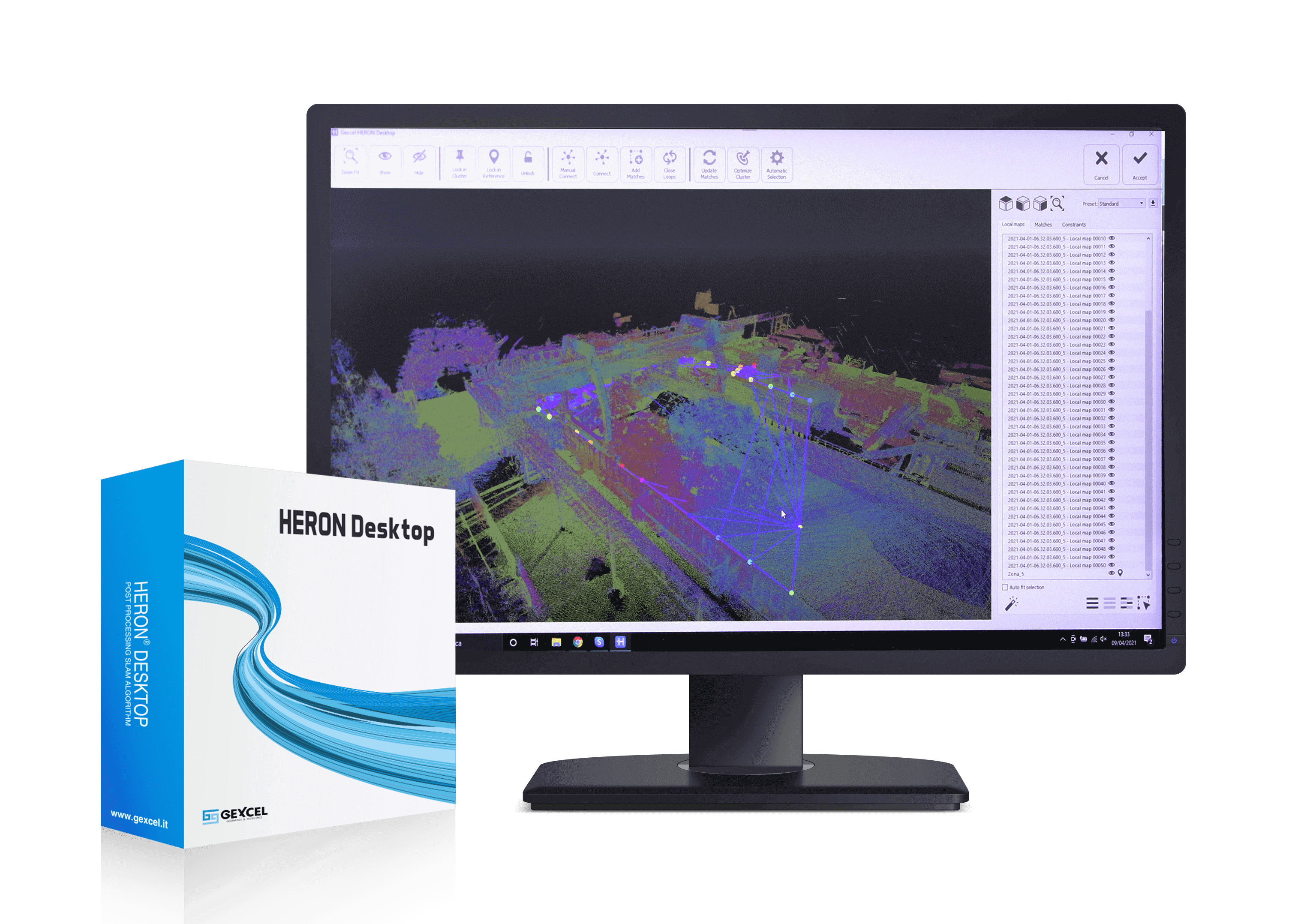
PROCESSING SOFTWARE FOR SLAM DATA FROM HERON
HERON Desktop is the processing software for data from HERON portable 3D mapping systems. Thanks to its powerful patented algorithms, it allows to manage acquired data completely automatically or leaving the user full control of parameters, optimizing the trajectory and the overall accuracy of the final model. With installation on their own workstation/pc, users maintain full control of data, preserving their confidentiality.
PORTABLE 3D MAPPING SYSTEMS
HERON is the indoor mobile mapping scanner designed by Gexcel. It features LiDAR sensors technology to offer a mapping system able to fit the most different acquisition needs.
E. This email address is being protected from spambots. You need JavaScript enabled to view it. | P. (+39) 030 6595001
CONTACT US